Storm-Speed City – 暴風速城市 Future Firm Throughout the 20th century, in addition to observation and collection, the Hong Kong Observatory was responsible for communicating information about impending storms—namely tropical cyclones, or typhoons—to the port city’s residents and shipping community. Initially, the signal systems were beacons hoisted at high points around Hong Kong. Over time, the Observatory produced a series of distinct signaling methods: local residents, for example, would await a second gunshot sound in anticipation of an approaching typhoon, while shippers looked out for red symbols turning to black to gauge their next steps. These signaling systems represented a responsive way of living with dynamic weather, in contrast to today’s engagement with unpredictable conditions characterized by risk management and control.
How can the Bay Area Region’s historic adaptability to diverse climates, emerging from its distinct geographic conditions, become a model for a transformative new form of urbanism and urban life? Storm-Speed City is a vision for a future city which moves at the speed of radar, from the scale of the picnic to the stock exchange. Storm-Speed City proposes a Hong Kong-Shenzen region where weather sensing and signaling become dramatically more distributed: from singular stations to a network of devices. Instead of observing time marked by a bell in the clock tower or the nine-to-five schedule, Storm-Speed City’s activities fluctuate around the temporality of shifting local weather and micro-climates.
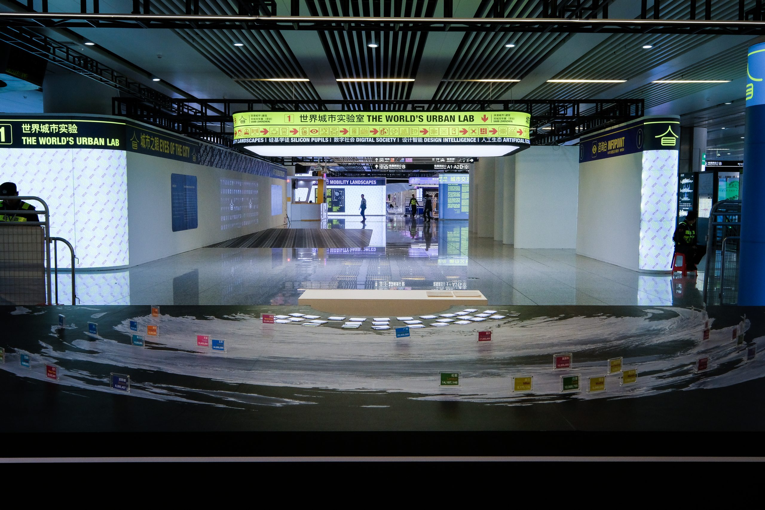
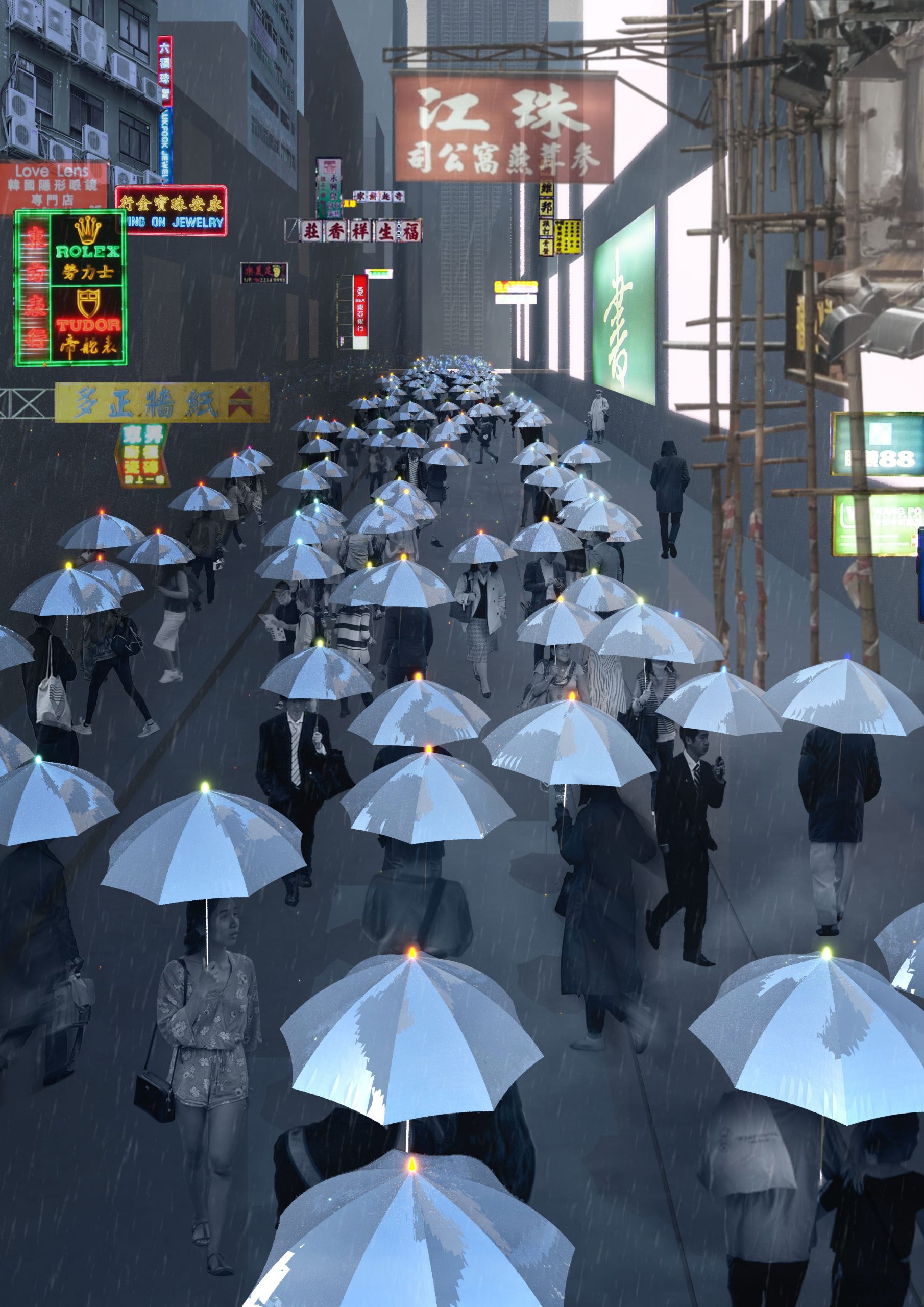
This speculation is exhibited through a large-scale model and three short films. The topographic model, spanning from harbor-depth to stratosphere, illustrates the changing metabolism of urban activities as weather conditions pass through. The films explore three time-scales: the history of typhoon-signaling (100 years); vignettes from daily life (1 hour); and new temporal and sensorial experiences (1 second). Examples from these films include: a walk to the office which is diverted when a group notice umbrella lights glowing green on the side street indicating a warmer micro-climate; a drone delivery route actively calculates to avoid impending clouds; and a small shop closes early to hedge against rising A/C costs on a hot afternoon.
Today, local observatories in the Bay Area Region have assembled diverse forms of meteorological data for public use. Contextualized by the increasing turbulence of climate change, Storm-Speed City explores a future city where new ways of living with unpredictable weather has transformed both the built environment and lived experience in the Bay Area Region. Climate change stresses the importance of exploring new forms of urban life: Storm-Speed City explores a way of life in tempo with the weather’s impending volatility.
在二十世纪,香港天文台除了观测天气和收集数据,还负责向市民和航运界预报即将到来的风暴──热带气旋或台风的信息。起初,信号系统是在香港各处的高地悬挂的信标。随着时间的转移,天文台发明了一系列独特的信令方式:例如,本地居民通过第二声枪响而预知台风的到来,而航运公司会留意红色的信号是否转黑,以权衡他们随后的动作。这些信号系统代表的是与动态天气互动的回应性生活方式,与人们今天在不可预知的环境中以风险管理和控制为特征的方式相异。
湾区因其独特的地理环境所形成的对多种气候的历史适应性,如何成为一种可转化的都市主义和城市生活的新模式?“暴风速城市”是一个有关未来城市的愿景,它以雷达般的速度移动,其规模从野餐覆盖到股票交易所。在该项目中,香港—深圳地区的天气感知和信令变得更加分散,从单一的站点发散到设备网络。“暴风速城市”中的活动,并非遵循钟楼或朝九晚五的时间表,而是因当地天气和微气候的变化而具有临时性。
此愿景通过一个模型和三部短片予以呈现。一个纵贯港口深度到平流层的地形模型,展示了不同天气下的城市活动。短片探索了三种时间尺度:台风信令的历史(100年),日常生活片段(1小时),以及新的时间和感观体验(1秒钟)。在这些短片中,观众将会看到:在前往办公室的路上,人群留意到横街的伞发出绿光,显示微气候变暖;无人驾驶飞机改变了送货路线,以躲避正在迫近的云层;一家小店提早关门,来控制炎热的下午空调费用的上升。
今天,湾区的天文台已收集了多种形式的气象数据为公众服务。在气候变化加剧的背景下,暴风速城市畅想了一个适应天气变化,创造新的生活方式,并改变湾区建成环境和生活经验的未来城市。气候变化映射了探索新的都市生活之重要性,因而“暴风速城市”探索的是一种与天气波动同步的可易性生活方式。
Credits: Ann Lui, Craig Reschke.
This website uses cookies to improve your experience. We'll assume you're ok with this, but you can opt-out if you wish. Cookie settingsACCEPT
Privacy & Cookies Policy
Privacy Overview
This website uses cookies to improve your experience while you navigate through the website. Out of these cookies, the cookies that are categorized as necessary are stored on your browser as they are essential for the working of basic functionalities of the website. We also use third-party cookies that help us analyze and understand how you use this website. These cookies will be stored in your browser only with your consent. You also have the option to opt-out of these cookies. But opting out of some of these cookies may have an effect on your browsing experience.
Necessary cookies are absolutely essential for the website to function properly. This category only includes cookies that ensures basic functionalities and security features of the website. These cookies do not store any personal information.
Any cookies that may not be particularly necessary for the website to function and is used specifically to collect user personal data via analytics, ads, other embedded contents are termed as non-necessary cookies. It is mandatory to procure user consent prior to running these cookies on your website.