Urban Witness: the transformation of Shekou Fishing Port
Urban Witness: the transformation of Shekou Fishing Port – 都市见证:蛇口渔港之转型 Ai Deng 艾登, Li Lipeng 李丽朋 , INTACT Studio Throughout the history of architecture up until quite recently, the best tools and techniques for perceiving, recording and representing space were oral descriptions, pictures, drawings and videos, amongst others. However, we believe these medium rarely allow us to have an immersive experience of a space and its transformation. In this exhibition, our team strives to expand the perception of urban space through the use of space sensing technologies. We capture the transformation of a specific urban form, while archiving the digitalized data, editing and presenting it as an immersive three dimensional experience. We hope this unconventional presentation offers the public a unique opportunity to witness a transformation, and thus spark a new interest on the issue of urban development.
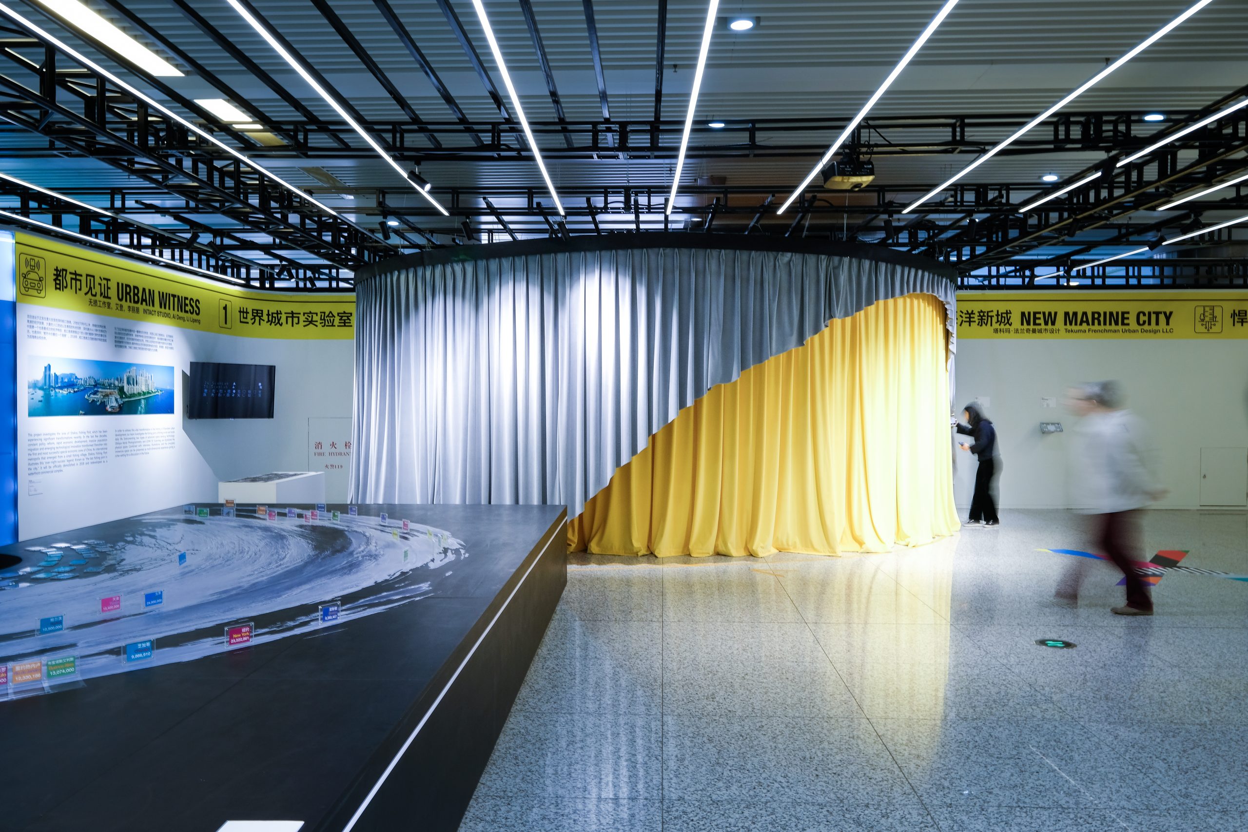
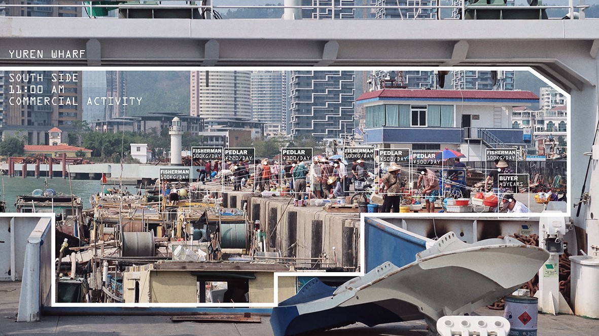
This project investigates the area of Shekou Fishing Port, which has been experiencing significant transformations recently. In the last few decades, constant policy reform, rapid economic development, massive population migration and emerging technological innovation transformed Shenzhen into the first and most successful special economic zone of China. An international metropolis that emerged from a small fishing village, Shekou Fishing Port illustrates this “over-night success” legend. Known as “the last fishing port in the city,” it was officially demolished in 2018 and will be redeveloped as a waterfront commercial complex.
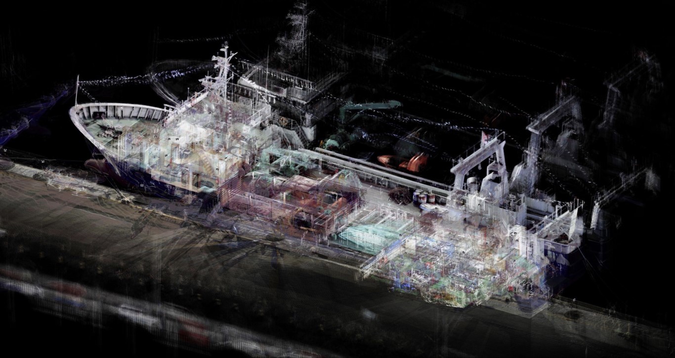
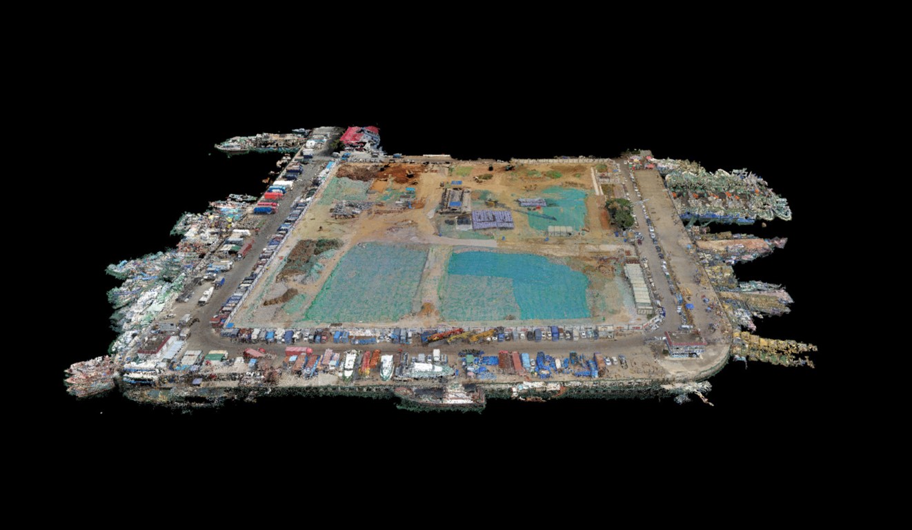
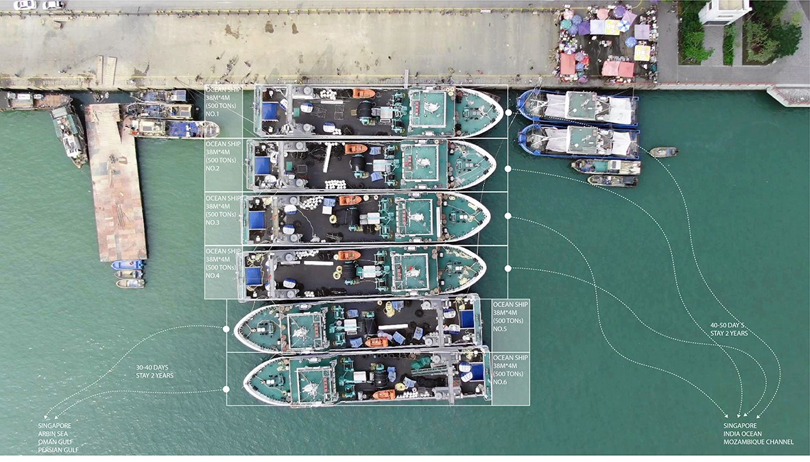
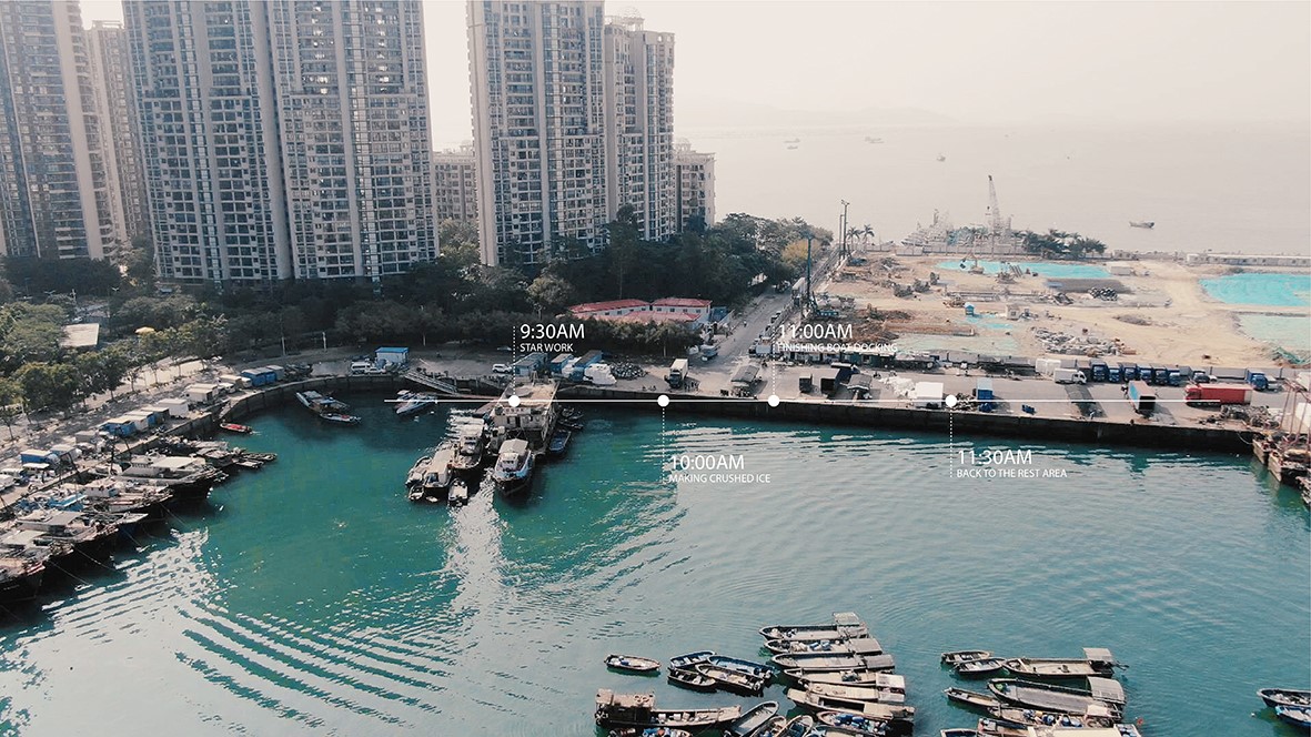
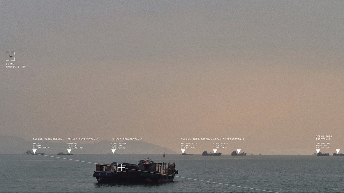
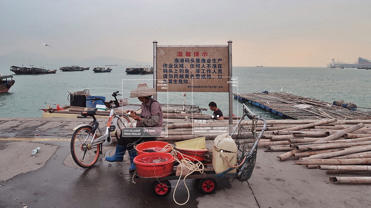
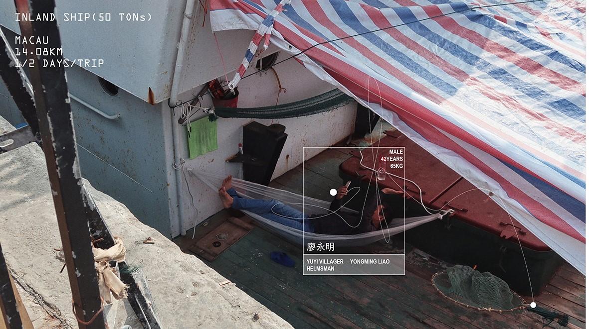
In order to witness this vital transformation in the history of Shenzhen urban development, our team investigates the fishing port, a fishing vessel and locals daily life. Instrumenting advanced space sensing technologies, we digitalized the physical space. Combined with interviews, illustrations, and the simulated immersive space can be presented as multi-dimensional experience giving a richer setting for a discussion in the future.
Our project explores two types of advanced space-sensing technologies: Oblique Aerial Photogrammetry captures series of overlapped images from orthogonal view and at multiple angles through sensors placed on a flying platform, which can then be processed by the computer and transcript into a virtual simulation; LiDAR 3D scanning (or light detection and ranging) is a remote sensing technology which uses the pulse of a laser to measure distances to and from an object, in order to collect three dimensional parameters and create a precise digital model.
在时间轴中,我们常常通过文字、图片、图纸、影像等方式观看历史,却无法身临其境地与过去的空间进行对话。本项目以空间感知技术为基础,记录特定城市形态的转变过程,通过一系列数字化处理,将空间信息进行存档、整理,并以三维的方式呈现。我们希望通过创造与以往不同的空间认知,为城市发展的讨论带来新的视点。
项目选址于正发生重大改变的深圳蛇口渔港。20世纪70年代以来,持续的政策改革、高速的经济发展、大量的人口流动以及涌现的科技创新,使深圳逐步从小渔村发展成为中国第一个也是最成功的经济特区,蛇口渔港便是这个小渔村最具代表性的标志,也是深圳“都市中的最后一个渔港”。2018年,蛇口渔港正式被拆除,并将被改造成为滨海商业综合体。
为了见证深圳城市发展中这一重要的历史转变,本团队以蛇口渔港码头、远洋渔船和码头渔民生活为研究样本,探索前沿的空间感知技术在空间调研领域的应用,并将以此获取的空间数字信息与访谈、图册等方式相结合,最终多维度、多层次地展现码头空间和城市发展的历程,为蛇口渔港之转型提供更丰富的讨论背景。
项目应用了以下两项前沿感知技术:航空倾斜摄影测量技术——以飞行器作为空中飞行操作平台,搭载多台影像传感器,从空中同时获取被测物的体垂直和倾斜等多角度、高重叠度、高分辨率序列影像,并用计算机对影像数据进行加工处理,从而获取被测物体的三维数据;三维激光扫描技术——通过向目标照射脉冲激光来测量目标的距离,来收集目标的三维参数。
Credits: Ai Deng 艾登, Li Lipeng 李丽朋 , Tao Huang 黄涛, Chow Waitat 邹伟达, Wong Chienbang 黄镇邦.
This website uses cookies to improve your experience. We'll assume you're ok with this, but you can opt-out if you wish. Cookie settingsACCEPT
Privacy & Cookies Policy
Privacy Overview
This website uses cookies to improve your experience while you navigate through the website. Out of these cookies, the cookies that are categorized as necessary are stored on your browser as they are essential for the working of basic functionalities of the website. We also use third-party cookies that help us analyze and understand how you use this website. These cookies will be stored in your browser only with your consent. You also have the option to opt-out of these cookies. But opting out of some of these cookies may have an effect on your browsing experience.
Necessary cookies are absolutely essential for the website to function properly. This category only includes cookies that ensures basic functionalities and security features of the website. These cookies do not store any personal information.
Any cookies that may not be particularly necessary for the website to function and is used specifically to collect user personal data via analytics, ads, other embedded contents are termed as non-necessary cookies. It is mandatory to procure user consent prior to running these cookies on your website.